Statistics Canada
www.statcan.gc.ca
Common menu bar links
(Note: Content area on this page may be wider than usual.)
The Great Regina Plain
Archived Content
Information identified as archived is provided for reference, research or recordkeeping purposes. It is not subject to the Government of Canada Web Standards and has not been altered or updated since it was archived. Please contact us to request a format other than those available.
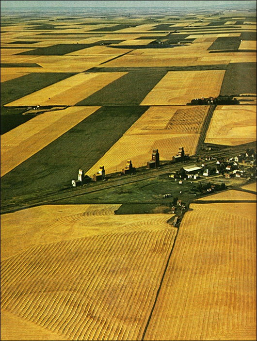
The vastness of Canada's territory posed a tremendous task for the early surveyors. Following a system devised in 1871, consisting of townships six miles square, each containing 36 sections of 640 acres, the Dominion land surveyors began to lay out the huge prairie chequerboard, using the 49th parallel as the southern boundary and ranging east and west of the prime meridian established that year in the vicinity of Emerson, Manitoba. About one third of the distance between the 49th and 60th parallels across the whole width of the prairies was completed by 1910 and with only minor adjustments these early survey lines remain today. From above the great Regina plain, the section lines bounding the east and west sides of the townships can be seen to run straight through to the horizon.
Copyright photograph: George Hunter, Toronto
Source: Statistics Canada, Canada Year Book 1967